Travel Utah: Discovering Nine Mile Canyon National Backcountry Byway
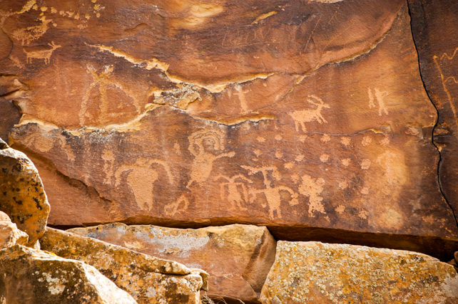
Nine Mile Canyon Rock Art ©RKCaton
Travel Utah: Discovering Nine Mile Canyon National Backcountry Byway
By Karen and Riley Caton
They are descriptive yet primitive, almost infantile. The inhabitants created them to tell their story and they have endured for centuries. They are a beautiful view into the past, an outdoor museum in the wilds of Utah!
Said to be the “world’s longest art gallery,” Nine Mile Canyon National Backcountry Byway is a must-see for those with an interest in ancient Indian rock art. The Canyon is a spectacular display of archaic, Fremont and Ute petroglyphs and pictographs that can easily be seen from your car. Over 1,000 sites and 10,000 images have been cataloged in the canyon and more are being discovered in side canyons along the 70-mile road.
An entry sign welcomes you to Nine Mile Canyon. ©RKCaton
LOCATION
The Canyon is located near Price, Utah, about two hours southeast of Salt Lake City. The best approach is from US Highway 6 in Wellington where you turn north on Soldier Creek Road. The National Backcountry Byway starts about 21 miles up Soldier Creek. Forty miles of the road are paved and an additional 38 miles of gravel road enable you to drive to Myton, UT to make a loop trip. However, the best rock art can be found along the 25 miles of paved road from Nine Mile Ranch to the Great Hunt Panel pull-out at mile 46.
TRAVEL TIPS
The road from Wellington to the Great Hunt Panel pull-out was paved in 2013 and is a smooth all-weather surface. The road to Myton, also part of the National Backcountry Byway, is gravel and is subject to washouts in rainy weather. However, regardless of the road surface, always be prepared when traveling in the backcountry. Carry extra clothing, food and water, start with a full fuel tank, and have a good spare tire. Watch for wildlife and cattle crossing the road and be prepared for loose rocks and snakes when walking through the area. Sturdy shoes or boots are helpful.
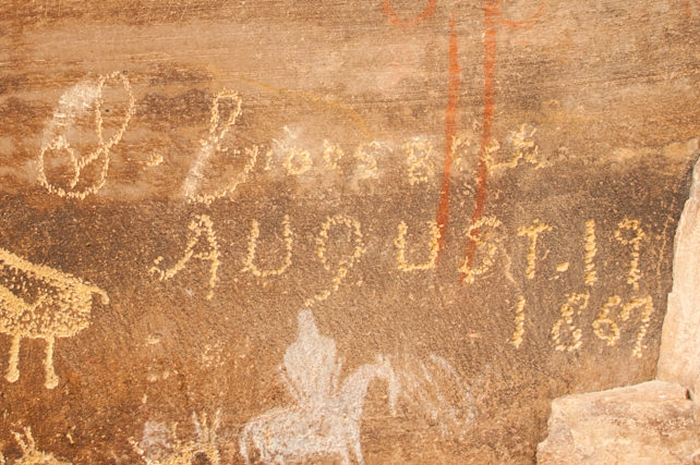
S. Groesbeck left his mark on the canyon walls in 1867. ©RKCaton
NINE MILE CANYON ROCK ART
Native Americans have inhabited the southwestern U.S. for thousands of years and their rock art can be seen throughout the Southwest. The Nine Mile rock art is the largest concentration of petroglyphs (images chipped in stone) and pictographs (images painted on stone) in the U.S. S. Groesbeck left his name on the canyon walls in 1867 and American fur trappers were probably the first whites to visit the Canyon. John Wesley Powell visited the area in 1869 while exploring the Green River.
The creek in the bottom of the canyon was named Nine Mile Creek by Powell’s topographer, F. M. Bishop. Bishop was using a nine mile transect to map the area and decided to name the creek Nine Mile. The name was changed to Nine Mile Canyon sometime later.
People are known to have lived in Nine Mile Canyon for over 8,000 years. The rock art in the canyon was the product of prehistoric cultures, ancient Native American tribes, and the Ute Indians. The majority of the images were produced by the Fremont Culture who lived in the canyon from 200 to 1200 A.D.
NINE MILE CANYON INFORMATION
The best way to tour the rock art is to pick up one of the free guides at the visitor information center in Price or Green River, depending on your route. Maps can also be downloaded from the Carbon County Tourism website or by Googling “nine mile canyon”. The visitor center in Price shares a parking lot with the College of Eastern Utah (CEU) Prehistoric Museum, also a very worthwhile stop.
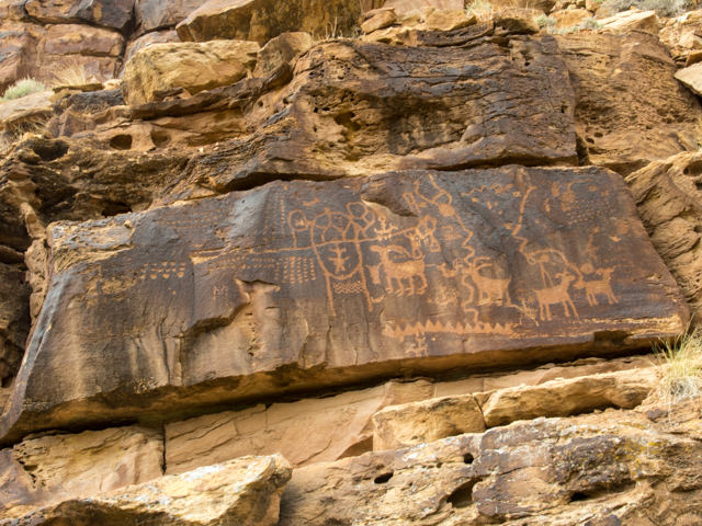
Rock art panel along a ¾ mile hike at the Daddy Canyon complex. ©RKCaton
PETROGLYPHS AND PICTOGRAPHS
So, what will you see? Beautiful rock art panels are easily accessed and small single images are seen from the car all along the route. While it is tempting to stop frequently, it is best to drive to the sites marked on the map where there is a safe place to stop. The first stop is at milepost 26.2 where you get your initial taste of what is to come. A short walk puts you face-to-face with the art. Remember, don’t touch or deface the rock. Even the natural oils in your skin can have a detrimental effect. There is a ghost town and picnic area just beyond the first stop.
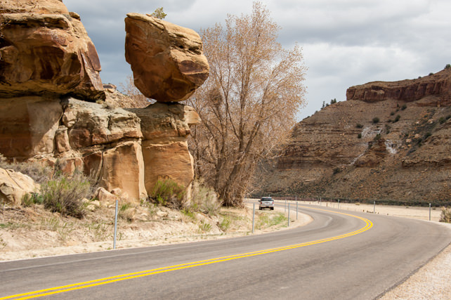
Geologic formation known as Balance Rock. ©RKCaton
Balance Rock (MP 31.9) is the next stop where you will see petroglyphs and an interesting geologic formation. You can view an ancient Granary at milepost 38.8. The most interesting and beautiful rock art panels are seen at the Daddy Canyon complex (MP 43.8), Big Buffalo (MP 45.7), and the famous Great Hunt Panel (MP 45.9).
The Daddy Canyon complex has a variety of images spread along a ¾ mile marked trail. All images are on the north side of the road, or left as you travel up-canyon. You’ll find a picnic area and restrooms here.
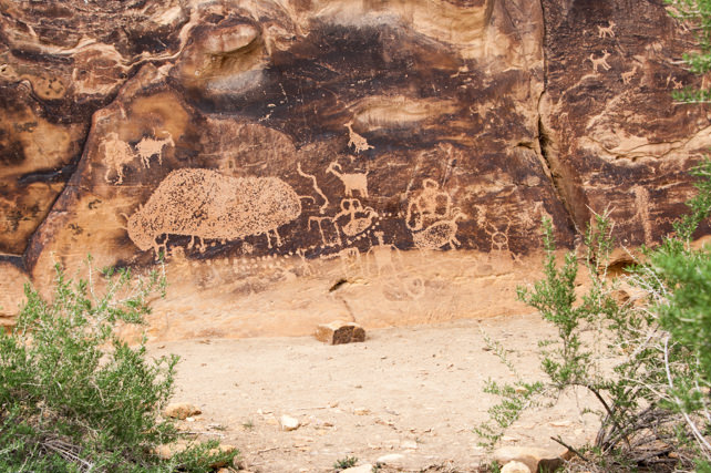
Located a short hike from the road, the Big Buffalo petroglyph is significant for its size and clarity. ©RKCaton
The Big Buffalo petroglyph is about 500 feet from the road and is worth the walk. It is the largest known buffalo petroglyph in the canyon. You will also see the unique Pregnant Buffalo along this walk. Park your car in the pull-out and cross the road toward the cliffs on the other side. Walk down through a small gully and proceed toward the cliffs to see the Big Buffalo. For the Pregnant Buffalo and other pictographs, turn left at the cliffs and follow the well-worn path to a fence where you have to squeeze between a fence post and the cliff. Continue following the cliff for another 50-100 feet.
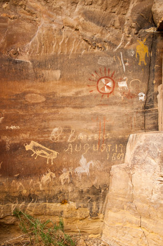
A panel of petroglyphs and pictographs near the Big Buffalo also feature an image known as “The Pregnant Buffalo”. ©RKCaton
Saving the best for last, the Great Hunt Panel is only two-tenths of a mile further up-canyon. While the panel can be seen from the road, it is best to park at the nearby pull-out and walk the short distance back to the viewing area. This spectacular panel has been featured in National Geographic magazine and is considered one of the finest examples of Fremont rock art.
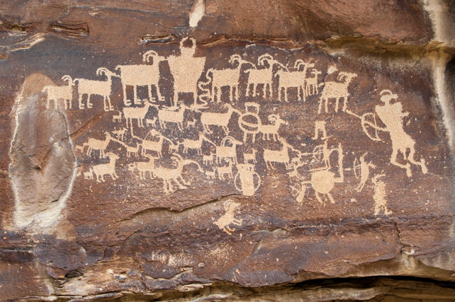
The famous Great Hunt petroglyph is easily accessed from a parking area along the road. ©RKCaton
Allow a full day to tour the Canyon or to make the 140-mile loop drive. There are no services beyond Wellington or Myton, so bring a lunch, drinks, and fill up the tank before leaving.
BIO
Karen and Riley Caton
Karen and Riley Caton are retired and having a grand time exploring North America, with a few side trips across oceans for some added fun. As full-time RVrs, they live and travel in “The Dip”, a 40’ Monaco Diplomat motorhome. Karen and Riley travel where the road leads, writing about and photographing the journey. You’ll never know where the two of them will show up next, but you can keep up with their adventures on their blog – On the Road with RK Caton!










One Response to Travel Utah: Discovering Nine Mile Canyon National Backcountry Byway