Recommended Hiking Trails & Training Tips

Recommended Hiking Trails
Canada
Trail Hikes – Hiking, kayaking, snow sports throughout Canada.
Turkey
Turkey has two long distance trekking routes: The Lycian Way –opened in 1999, and The St Paul Trail –opened in 2004.
France
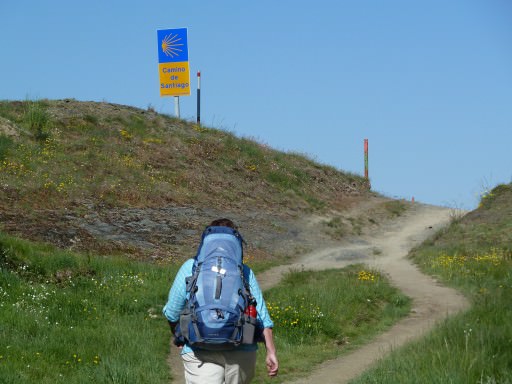
For long hikes across France follow the GR65 from Le Puy to St. Jean pied-de-Port. See the Camino section for more details of this 900km hike.
Italy
Follow the 300km route of the Camino de Assisi.
Hiking the Cinque Terre.
Spain
Follow the 850km hiking route of the Camino Frances from Roncesvalles to Santiago de Compostela. Full details in the Camino section.
Training Tips for Hiking
– 8 week hiking training program for Kilimanjaro
– Train for high altitude hiking along the Inca Trail
– ABC-of-hiking
– Articles for training for hiking and backpacking
– Leg Cramp Remedies
Recommended Hiking Trails in Canada -British Columbia
Cultus Lake
– Teapot Hill – Rating: Easy, Distance: 6km return, Time: 2hrs, Elevation Gain: 280m, Highest point: 360m.
Views of Cultus Lake, some steep areas, carry water.
Directions: Follow signs to Cultus Lake Provincial Park, drive 3km through the park to the sign for Teapot Hill (on left side of road) and paved parking area for the trail.
Cultus Lake
– Vedder Mountain Ridge Trail – Rating: Moderate,
Distance: 11.5km return, Time: 5hrs, Elevation Gain: 575m, Highest point: 945m.
Great trail through the trees and easy to navigate in rain or snow. Many viewpoints along the trail and a great 360 views from the top. Some rocks to climb close to the top, carry water and food.
Directions: On the road to the Cultus Lake Provincial Park, watch for the “Welcome to Cultus” sign on the left, pass it and turn right onto Parmenter Road (gravel and bumpy) at the next corner. After 600m turn right, another 600m turn left (Vedder Mountain Forest Service Road), continue uphill for 3km. Watch for trailhead signpost on the right. Park beside the road. Walk up old dirt road for 1km and them take the first left and follow another dirt road to a clearing. Trail is to your right and gets very scenic from this point on.
Cultus Lake
– International Ridge (Mt. Amadis) – or as named by WJ readers who hiked this, Mt. Severe!
Rating: Advanced, Distance: 16km return, Time: 8hrs, Elevation Gain: 1445m, Highest point: 1506m.
Pay close attention to markers along this trail full of switch backs. Some tricky slide areas close to the top. Fabulous views if you make it. Take lots of water and food. Follow signs to Cultus Lake and continue 1km past Sunnyside Campground, and just before the marina on the right, watch for Edmeston Road (gravel road on left). Park at the pullout on the main road, cross to Edmeston. You will start your hike here. Walk on the gravel, turning right at the second gate (good bridge and Park Boundary sign), stay on this old road for 3km, ignoring the Horse trail sign to the right, keep left, continue on switchbacks up to the next fork. Take a left, cross a shale slide and then keep a look out for a huge mass of multi-colored ribbons on the right. Follow the trail from here.


